Data Source
Infomaptic combines templates with data to generate reports. In order to do that it needs a Data Source. The data source can be any map or feature service that contains records. Each record in the data source yields one report (one record is combined with the template to generate a report).
For more about how records, templates, and data sources interact see Templates and Reports.
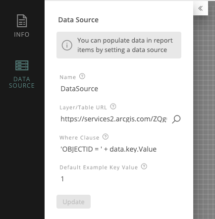
To provide a data source you can copy and paste the URL to the layer or table (That means it needs to have a layer number on the end, like /1) or click the magnifying glass to browse your layers in ArcGIS Online.
Select a Data Source
Clicking on the magnifying glass allows you to search for a data source in ArcGIS Online. You can search within your own content, your organization’s, or all of ArcGIS Online.
To Change your search type, simply select the appropriate option from the dropdown to the right of the search box.
You can search using keywords, or enter an ItemID to open that item directly. You can also paste a URL for a service directly into the box and as long as it is public, or your portal token has access to it, it will work! 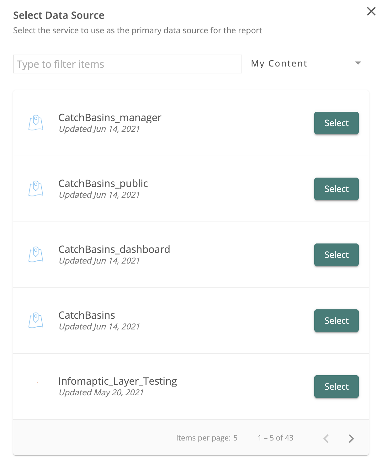
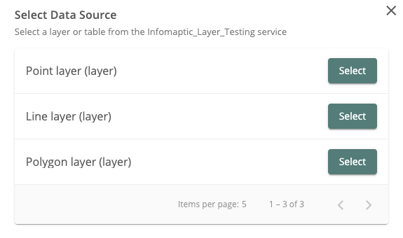
If the layer has multiple sub-layers, you may be prompted to select the appropriate sub-layer with an additional screen:
You must also specify a where-clause that is used to select a single record for each report that is generated (see Templates and Reports for details).
Custom URLs
If you have a MapService or FeatureService that you want to use instead of searching for a data source, you can. Simply paste the URL to the service into the search box and we will use that as your URL. It must meet the following criteria:
- Should end with
MapServerorFeatureServer(If you want a specific layer, that’s okay, we’ll prompt you to select the layer you want). - Must be
https, we won’t recognize anhttpURL for security reasons - Must be shared publicly. Our servers need to have direct access to the Service. If you want the service to be secured, register it with your Portal (ArcGIS Online or Enterprise) and find it by searching in the Select Data Source dialog.
Advanced Search
You can leverage some advanced search options when entering search terms. By default the terms are applied widely across title, tags and description, however you can search for specific attributes by specifying them in the search box. For example, you could limit your search to only items with the tag “dymaptic” by using tags: dymaptic as the search string. The following is a list of common search attributes:
title- Searches specifically in the title attribute of the items:title: Parcelswill return items with the word Parcels in the title.tags- Searches specifically in the tags of the item:tags: infomapticwill return items that have the taginfomaptic.owner- Searches specifically for items owned by a certain user as specified by their username:owner: moraveclabsonlinewill return all items owned byMoravecLabsOnline.description- Searches within the description of items:description: parcelswill return different results than a simple search forparcels.
Internally we are leveraging the ArcGIS Search API, so you can craft very complex search strings. See the documentation for more details. Be aware that we will always add to the end of your search string to ensure that we are only getting layers back that are support by Infomaptic (Map and Feature Services).
Technical Details
An infomaptic data source can be a single layer within either a Map or Feature Service. It can be a layer or a table. It must be accessible to you, and anyone that you share the report with must also have access to the layer.
Infomaptic respects all ArcGIS Online Security, so if you have per row security turned on, Infomaptic will respect that as well (technically ArcGIS is enforcing it, so we cannot not respect it)
The layer must have a layer number on the end of the url, like /0 or /1. Here are a few example layer URLs that would work:
https://arcgis.dymaptic.com/server/rest/services/Hosted/Infomaptic_Layer_Testing/FeatureServer/0https://services2.arcgis.com/ZQgQTuoyBrtmoGdP/ArcGIS/rest/services/AlaskaNationalParksPreserves_Update/FeatureServer/0
These urls will usually have the form of: https://server.com/server/rest/services/servicename/{FeatureServer | MapServer}/{LayerIndex}