Release Notes
September 19, 2023 (20230912.1668.1)
- Added Swagger API doc with testing support (583)
- Update api docs to match
August 31, 2023 (20230821.1666.1)
- Retiring the Slack link. Discord is where it’s at! (654)
August 21, 2023 (20230821.1666.1)
- Fixed the scroll bar that was missing in the report viewer (678)
- Fixed links to terms of service
June 9, 2023 (20230609.1656.1)
- Fixed some annoying email copy (676)
- Fixed the “Buy Infomaptic” button so that it is a big button, not a small link! (675)
April 7, 2023 (20230407.1588.1)
- Finishes adding support for ‘MultiPoint’ geometries in maps (666)
- Removes Python as a scripting language (it was too slow, and we had removed the UI a while back)
- Updates to map printing, they are much, much faster now (667)
March 29, 2023 (20230330.1581.1)
- Adds support for
MultiPointgeometries
March 3, 2023 (20230304.1579.1)
- Updated CSP headers to be more restrictive
February 16, 2023 (20230217.1577.1)
- Fixed an issue where hiding an item with Z-Indexes didn’t hide the background (662)
- Fixed a login issue where we were sending you to the portal login instead of ArcGIS Online (631)
- Fixed an issue where selecting a layer that didn’t have a
0index sub layer would throw an error (661)
February 7, 2023 (20230208.1574.1)
- Add support for custom CSS! You can add custom classes in the info panel and assign them to items. (656/51)
- Add Z-Index Support! You can now put items on top of each other! (581)
- Add
SumandAvgsupport to atlerix list functions (657)
January 20, 2023 (20221130.1546.1)
- Fix the map documentation to have an example of using Atelerix to process the webmap json. (641)
November 29, 2022 (20221130.1546.1)
- Added
IsNumberto Atelerix (612) - Added admin UI to support direct JSON editing for advanced scenarios.
- Updated graphs to allow lines and columns on the same chart (637)
November 7, 2022 (20221108.1542.1)
- Added the ability to tables to overflow onto many pages instead of being constrained (621).
October 18, 2022 (20221018.1540.1)
- Fixed a bug on the publish dialog where if you were using Enterprise, the open in another tab button didn’t work (627)
September 27, 2022 (20220927.1538.1)
- Updated the docs for Understanding Templates and Reports
- Fixed a bug where the Trial Text caused other buttons to look bad (623)
August 19, 2022 (20220819.1536.1)
- Fixed a bug where some bold fonts where not showing up in PDF files (609)
August 10, 2022 (20220810.1532.1)
- Fixed a bug when pasting valid Map or Feature service urls that caused the app to fail to connect to them (615)
- Fixed an issue with older (10.6 at least) ArcGIS Server services where we were specifying a
distanceparameter of0and those older servers didn’t like it. We no longer specify it at all. (617)
August 9, 2022 (20220809.1524.1)
- Published reports now hide Atelerix Errors (but they are still shown in the preview window)
- Fixed some upstream unit tests so that they are not executed in our test pipeline
- Fixed a docker dependency that was preventing us from deploying
May 25, 2022 (20220525.1329.1)
- Improved the UI tip when browsing for Portal items to indicate that you can: search, enter an Item ID, or a URL for a service.
- Added to documentation to indicate the above change.
May 23, 2022 (20220516.1202.1)
- Added database indexes to speed report generation / billing statistics.
May 16, 2022 (20220516.1202.1)
- Fixed a bug where some maps didn’t zoom correctly to the default extent (440)
- Fixed a bug in the Admin page where the UI didn’t load correctly (602)
May 10, 2022 (20220511.1157.1)
- Fixed a UI bug in the table designer that made the text box way smaller than it should have (597).
- Changed caching for public reports to be a sliding 30 minute timeout instead of an absolute 5 minute timeout.
April 22, 2022 (20220422.1030.1)
- Fixed a bug where (randomly?) the application crashed b/c of a null reference exception in a socket thread (not in our code)(594).
April 21, 2022 (20220421.1025.1)
- Implemented our custom print service! (maps now take about 1/3 the time they used to)
- Implemented smart map caching so that we don’t generate the map if it hasn’t changed (Note: if you change the data in the map, it may take about 5-10 minutes before the map will refresh)
- Improved the PDF generator with better font support
- Fixed a bug where, sometimes, two PDFs at the same time would cause one to fail
April 15, 2022 (20220405.850.1)
- Added a video tutorial to Creating your first Report
- Added an overview of the designer to the Docs landing page
April 7, 2022 (20220405.850.1)
- Added the API to the documentation
April 5, 2022 (20220405.850.1)
- Added a switch to turn off the live preview!
- Fixed a bug in the preview so that blank templates show up correctly now.
March 21, 2022 (20220320.778.1)
- Upgraded to .Net 6 and made some performance improvements to the handling of Images
- You can now filter attachments by using a regular expression on the field name. Using this you can limit what attachments are shown, like only show the one called
Signature! - Set a maximum number of attachments returned.
March 3, 2022 (20220304.742.1)
- Fixed a bug in Atelerix JSON parsing so that you can now correctly get the user that is currently logged in by calling the
/selfarcgis endpoint.
March 1, 2022 (20220302.730.1)
- Adds the GetVar function to Atelerix
February 25, 2022 (20220225.716.1)
- Added better support for new templates, and added a new template (more soon about Thumbnails and image generation)
February 21, 2022 (20220222.682.1)
- Added a search/filter box to the field dropdown when adding a table
- Fixed some typos in the docs and the app, we now use
where-clauseevery where andURL
February 7, 2022 (20220207.602.1)
- Fixed a bug in Atelerix JSON parsing
- Improved map generation by ensuring they are done in parallel when you have more than one map.
February 3, 2022 (20220203.585.1)
- Added the ability to change the order of pages
January 20, 2022 (20220120.553.1)
- Updated the attachment item to request smaller attachments from ArcGIS if the service supports that (https://developers.arcgis.com/rest/services-reference/enterprise/attachment-feature-service-.htm)
January 17, 2022 (20220117.551.1)
- Changed the way the position text is displayed in an item so that it’s always visible and isn’t overshadowed by the content of the item
- Fixed a bug in the data source selection where if the layer you were selecting from had multiple layers the pagination got confused, it works now!
January 13, 2022 (20220114.547.1)
- Holding down the
altkey in the designer hides the edit menu on items so you can more easily get to them when they are small - Double clicking on an item in the designer opens it’s edit dialog (even while holding down
alt) - Holding down
alt+shiftand double clicking an item in the designer prompts you to delete the item
January 11, 2022 (20220112.545.1)
- Fixed an issue with
Json.StringFromURLthat caused it to fail if the service returned a 404 error, we now show an appropriate exception/message. - Fixed a bug in atelerix that prevented you from concatenating things like this:
Text(5) + ' %'. You can do it now! - Fixed an issue in multi-line atelerix expressions where the “Run” button didn’t return example data correctly
January 7, 2022 (20220108.539.1)
- Add a new Embedded Viewer so that you can add reports to operations dashboard
- Fixed a bug where we were incorrectly identifying templates/counts for licensing
- Removed some redundant REST api calls so speed up report generation a little tiny bit
December 28, 2021 (20211228.534.1)
- Updated admin page so that it looks better on small screens
- Updated billing page so that it looks better on small screens
- Made the plan name you are currently on more clear
- Updated the login page so that the bottom doesn’t get cut off on smaller screens
- Removed redundant login button from login page
- Changed admin page to be more clear about billing cycles and dates
- Fixed a bug in the admin page that didn’t show counts correctly for some license types
December 22, 2021 (20211221.526.1)
- Refactored some of the scripting backend to improve performance
December 20, 2021 (20211220_524.1)
- Fixed a bug that was showing the spatial filter in the main data source tab. (No you can’t use a spatial filter there!)
December 16, 2021 (20211216_522.1)
- Fixed a bug with the font properties for the rows in a table
December 15, 2021 (20211216_521.1)
- Added support to set a Table Header font properties
- Added support to set table row font properties
- Added support to enable table borders and set colors
- Added support to align the header in the horizontal space (controlled per column)
- Added support to align the row in the horizontal space (controlled per column)
December 15, 2021 (20211214.517.1)
- Fixed a bug in Table where adding a new table from an existing relationship caused an infinite loop!
December 11, 2021 (20211211_514.1)
- Added support to filter records by geometry. If the primary record has a geometry the related features can be filtered by that geometry.
- Pipelined the preview so that it only makes on request at a time, and only uses the last one to refresh (this should reduce load and make the app perform better)
December 10, 2021 (20211210_511.1)
- Added honeycomb / open telemetry
- Fixed the viewer so that users don’t need to have an infomaptic license to view a report shared with them
December 8, 2021 (20211209_508.1)
- Updates to fully support the new Flex white label plan
December 6, 2021 (20211204.503.1)
- Adds support for Order By in a related table
- Adds support of limiting the number of records returned in a related table
- Adds BETA support for python as a scripting language
- Adds A scripting hook in maps that allow you to alter the ArcGIS Webmap JSON before it is sent to the printer. This is especially useful if you want to alter the map (like turn layers on or off) based on data in the primary data source.
November 12, 2021 (20211111.494.1)
- Added a page break item in dynamic mode. To force a page-break anywhere in your page, place that item in the grid. Other items that are in the same row will be ignored, you should place a page-break all alone on one row.
- Added support for multiple pages in pixel mode. You can now add pages and design each page separately in pixel mode!
- Added a special variable in expressions to print the page number automatically for you
report.PageNumber - Fixed the “jiggle” / infinite scroll bug when positioning things at the bottom of pixel mode
- When dropping items in pixel mode into a small space, they now try to fill the space available instead of jumping to a new location.
- Limited the size of images that can be uploaded with a template to 1MB to prevent memory crashes, if you need larger please upload them somewhere else and reference them by URL.
- Prevents you from uploading SVG images now, as those are not supported
- Creating new Dynamic mode templates is no longer supported (you can still edit existing ones though)
November 5, 2021 (20211029.485.1)
- Added multi-line support in labels. You can now author multiple lines of text in one label!
October 28, 2021 (20211021.482.1)
- Add Intelisense for Atelerix in Expressions!
October 15, 2021 (20211015.476.1)
- The designer wasn’t allowing drag/drop operations in firefox, that’s fixed now
- When dropping items, you couldn’t really line them up with the top and left edges, you can now!
- When dropping items in Safari, the items sometimes jumped to a different location, no more!
October 13, 2021 (20211012.470.1)
- Fixed an issue where the preview window wasn’t displaying on narrow screens
- Added the ability to resize the preview window
- Fixed issue where putting in a non integer for a border width caused the preview to fail. That wasn’t allowed, so now you get a message bout it instead of it just failing!
October 11, 2021 (20211011.465.1)
- You can now pay us automatically! Before you had to email us and we would setup the payment, now you can buy infomaptic directly from the app!
- The new https://app.infomaptic.com/admin page lets you know how many report views you have used and how many you have left for your billing cycle
September 23, 2021 (20210923_448.1)
- Fixed an issue with webmaps where if the map had non-URL based layers it would fail to load.
September 15, 2021 (20210915.442.1)
- Fixed a rather embarrassing regression where the issue that we fixed in
20210908.431.1was back again after doing the ArcGIS Enterprise updates. It is nice to have great users!
September 14, 2021 (20210915.441.1)
- Changed email providers and connected up onboarding emails for new users.
September 13, 2021 (20210913.439.1)
- Added full support for logging in to ArcGIS Enterprise! You can now follow instructions in the docs to configure it and link to Infomaptic.
September 8, 2021 (20210908.431.1)
- Fixed a bug when selecting a map that sometimes caused you to just get a spinner progress dialog forever… that doesn’t happen now!
August 30, 2021 (20210831.429.1)
- Image item only supports HTTPS for increased security
- When browsing for a data source you can now paste a URL for a MapService or FeatureService directly into the search box and we will consume that! More information in the docs for Data Source
- Fixed an issue with setting the rotation angle of an image so that it now works.
- Added popups to help you get started and an automated email that points you to the app and documentation links
- Setup our discourd community, join us here: https://discord.gg/wZA4X9yTfq
August 18, 2021 (20210818.414.1)
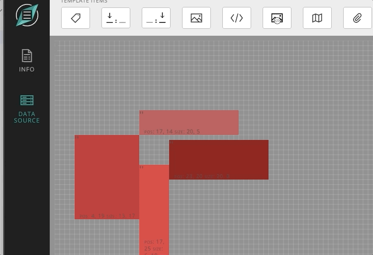
- Added position text to each item in pixel mode to make it easier to line up and understand the sizes of items.
- Updated the Getting Started Guide
August 17, 2021 (20210818.413.1)
- Changed the way new users are onboarded so that you don’t have to wait for registration, you can start your trial right now!
August 13, 2021 (20210813.410.1)
- Add a button on the dashboard to open the template item in ArcGIS Online.
- Added tooltips to layer and map names in the data source explorer so that names longer than the space visible can still be seen by hovering over the name to get the tooltip to appear.
- Cleaned up and standardized tooltips so they are working on icons within the editor, should help you know what’s going on better!
- Added options to open items in the data source explorer, you can now open the arcgis online item, or the rest endpoint to see details!
July 21, 2021 (20210722.397.1)
- Added Support for Attachments. If your Data Source supports attachments, you can now add them to reports. We’ve provided a very specific set of features for this release: include image, include non-images, display attachment names and URLs.
- Added support for related tables. If your data has related tables, you can now add those to your reports as Tables. Tables that have relationships will be connected automatically, but you can also make joins to other feature classes or tables by building your own where-clause.
- Updated these documents to contain more information about the different items (including the two new ones) that you can use.
- Updated these documents with more descriptive information on the difference between pixel and dynamic mode, with pictures!
July 9, 2021 (20210709.381.1)
- Reduced default image size in both pixel and dynamic mode. The default size was too large and some reports would allow you to drop an image, but it would disappear from the designer, which is less than ideal!
July 7, 2021 (20210707.379.1)
- Enhanced the “New Template” dialog so that you know enter the name of the template and the data source before you start designing the template.
- When selecting a data source via the New Template dialog, the where-clause is created automatically for you. You can always change it in the Data Source properties of the Template.
July 6, 2021 (20210707.377.1)
All of these came directly from user feedback 🎉
- Updated Search Box on the Select Layer screen so that it searches on all attributes via the ArcGIS Search api (really we just removed the quotes around the search text that you entered)
- Bonus from above! You can now use search attributes like
tags: infomapticin your search strings! - Replaced the check box with a drop down so that you can search any of: “My Content,” “Organization’s Content” or “ArcGIS Online.
June 30, 2021 (20210630.373.1)
- Made the version number visible in the footer of the application so that it is linked to this change log / release notes page.
June 17, 2021
- Removed the “Name” property from the DataSource panel since it’s not needed here.
- Added logging to help with license management
- Increased the width of the field name and field value dropdown so that long file names are easier to read
June 11, 2021
- Moved / Split the buttons in the designer to make them more straight forward.
- Added “Save-As” so that you can easily make copies of templates that you don’t own (or ones that you do)! Just open the designer to that template and use the down arrow next to “Save” to get to “Save-As”.